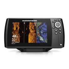
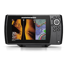
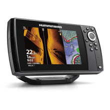
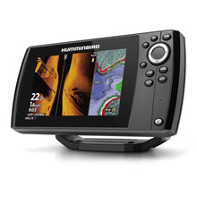
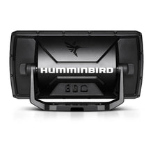
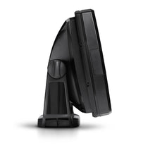
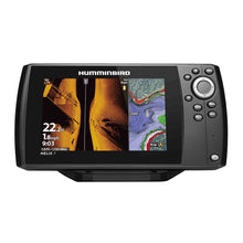
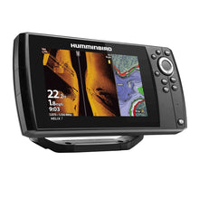
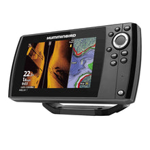
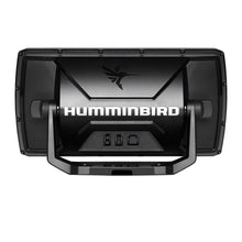
Humminbird HELIX 7 CHIRP MEGA SI GPS G4 Fishfinder - 7-Inch High-Definition Display with Advanced Imaging Technology
Experience exceptional underwater clarity with the Humminbird HELIX 7 CHIRP MEGA SI GPS G4 fishfinder, featuring MEGA Side Imaging, MEGA Down Imaging, Dual Spectrum CHIRP sonar, and built-in GPS chartplotting for comprehensive fishing success.
Professional-Grade Fishfinder with Advanced Imaging
The Humminbird HELIX 7 CHIRP MEGA SI GPS G4 represents the pinnacle of fishfinding technology, combining cutting-edge sonar imaging with precision GPS navigation in a single, powerful unit. This professional-grade fishfinder delivers crystal-clear underwater views with up to 3x more detail than standard imaging systems, giving serious anglers the competitive edge they need to locate and catch more fish.
The upgraded high-definition 7-inch display provides exceptional clarity with 1024 x 600 pixel resolution, offering multiple pre-loaded split-screen view options that ensure you'll never miss a fish or critical underwater structure.
Revolutionary MEGA Imaging Technology
MEGA Side Imaging - See 125 Feet on Each Side
MEGA Side Imaging technology transforms underwater exploration by providing crystal-clear viewing out to 125 feet on either side of your boat. This advanced sonar system delivers up to 3x more detail than standard Side Imaging, revealing fish, structure, and bottom composition with unprecedented clarity. Whether you're searching for schools of baitfish, fallen trees, rock piles, or other fish-holding structure, MEGA Side Imaging shows you exactly where to cast.
MEGA Down Imaging - Pinpoint Precision Below
The MEGA Down Imaging system provides unmatched underwater clarity with coverage down to 125 feet directly below your boat. This high-frequency imaging technology delivers incredibly detailed views of bottom structure, vegetation, and fish, allowing you to distinguish between species and identify the most productive fishing spots with confidence.
Dual Spectrum CHIRP Sonar Technology
Before you cast, know exactly what's down there with Dual Spectrum CHIRP sonar technology. Powered by Humminbird's proprietary Low-Q CHIRP transducer, this advanced sonar system provides highly detailed fish arches and crystal-clear views of fish-holding structure and bottom composition.
The system offers two distinct search modes:
- Wide Mode (140-200 kHz): Maximum coverage for scanning large areas efficiently
- Narrow Mode (180-240 kHz): Focused beam for examining fine details and individual targets
- Full Mode (150-220 kHz): Comprehensive coverage combining both approaches
CHIRP technology covers frequency ranges from 83/200 kHz (75-155/130-250 kHz), providing superior target separation and fish identification compared to traditional single-frequency sonar.
Built-in GPS and Advanced Chartplotting
Precision GPS Navigation
The integrated precision GPS system provides accurate position fixing for better waypoint marking and boat positioning. Store up to 2,750 waypoints to mark your most productive fishing spots, structures, and navigation hazards with pinpoint accuracy.
Comprehensive Humminbird Basemap
Navigate and fish with total confidence using the enhanced Humminbird Basemap, which provides clear views of underwater terrain and surrounding points of interest. The basemap includes:
- Charts of more than 10,000 lakes
- Complete coastal coverage for the continental United States
- Detailed contours and depth markers
- Buoys, day markers, and navigation hazards
- Marinas and boat ramps
- Points of interest for enhanced navigation
AutoChart Live Real-Time Mapping
AutoChart Live technology creates real-time maps of your fishing spots with access to patented Humminbird LakeMaster features. As you drive your boat, the system automatically maps depth contours, bottom hardness, and vegetation, building a comprehensive picture of underwater terrain.
Key AutoChart Live features include:
- Eight hours of built-in recording time
- Real-time contour mapping
- Bottom hardness analysis
- Vegetation mapping
- Compatible with AutoChart Zero Line SD cards for unlimited mapping capacity
- Access to LakeMaster features and depth highlights
Premium Chart Compatibility
Expand your fishing capabilities with compatibility for premium chart options from industry leaders:
- LakeMaster Charts: Unrivaled easy-to-read contours and highlighted depth ranges
- CoastMaster Charts: Comprehensive coastal navigation data
- Navionics Charts: Gold, Platinum+, and HotMaps compatibility
- SmartStrike Cards: Advanced fish patterning and location algorithms
User-Friendly Operation and Controls
Master your HELIX 7 at the touch of a button with keypad control system designed for reliable operation in any weather conditions. The user-friendly menu system features softkey controls that provide quick access to all fishfinder functions, even when wearing gloves or in rough water conditions.
The X-Press Menu System delivers intuitive navigation through all features, while custom digital readouts allow you to personalize your display with the information most important to your fishing style.
Advanced Connectivity and Integration
The HELIX 7 CHIRP MEGA SI GPS G4 offers extensive compatibility with marine electronics and accessories:
- AIS Integration: Automatic Identification System compatibility for enhanced navigation safety
- Autopilot Compatibility: Interface with compatible autopilot systems
- Minn Kota Integration: US2 sonar and built-in MEGA DI compatibility
- Heading Sensor GPS: Enhanced positioning accuracy
- Upgradable Software: Keep your unit current with latest features
Complete System Specifications
Display and Interface
- Display Size: 7-inch diagonal LCD
- Resolution: 1024 x 600 pixels
- Interface: Keypad control with softkey operation
- Colors: 16-bit grayscale display
- Memory Card: Single Micro SD slot
Sonar Performance
- Power Output: 4000 watts peak-to-peak, 500 watts RMS
- Depth Capability: 1,200 ft (standard), 3,500 ft (optional 50 kHz)
- MEGA Down Imaging Range: 75 feet depth
- MEGA Side Imaging Range: 250 feet (side-to-side)
- Frequencies Supported: 50/83/200/455/800 kHz & 1.2 MHz
- CHIRP Imaging Frequencies: 455 kHz, MEGA DI/SI (1075-1150 kHz)
Physical Specifications
- Dimensions (Gimbal Mount): 10.54" W x 5.8" H x 3.68" D
- Power Requirements: 10.8-20 VDC, 800 mA draw
- Waterproof Rating: Marine-grade waterproof construction
- Transducer Mount: Transom-mount configuration
Complete Package Contents
- HELIX 7 Control Head: Main display and processing unit
- XNT-9-HW-MSI-150-T Transducer: MEGA imaging and CHIRP sonar transducer
- Power Cable: Marine-grade power connection
- Gimbal Mounting Bracket: Adjustable display mounting system
- Mounting Hardware: Complete installation components
- Documentation: Installation guides and operation manual
Why Choose Humminbird HELIX 7 CHIRP MEGA SI GPS G4
The HELIX 7 CHIRP MEGA SI GPS G4 represents Humminbird's commitment to providing anglers with the most advanced fishfinding technology available. With its combination of MEGA imaging, CHIRP sonar, GPS navigation, and real-time mapping capabilities, this unit gives you every advantage needed to find and catch more fish.
Whether you're tournament fishing, weekend angling, or exploring new waters, the HELIX 7 provides the detailed underwater intelligence that separates successful anglers from the rest. Backed by Humminbird's reputation for innovation and reliability, this fishfinder delivers professional-grade performance at an exceptional value.
Frequently Asked Questions
What makes MEGA imaging different from standard imaging?
MEGA imaging technology provides up to 3x more detail than standard Side and Down Imaging systems. Operating at higher frequencies (1075-1150 kHz), MEGA imaging delivers crystal-clear views of underwater structure, fish, and bottom composition with unprecedented clarity and resolution.
How does CHIRP sonar improve fish detection?
CHIRP (Compressed High Intensity Radar Pulse) technology sweeps through a range of frequencies rather than using a single frequency. This provides better target separation, more detailed fish arches, and clearer distinction between fish and structure compared to traditional sonar.
Can I create my own maps with this unit?
Yes, AutoChart Live technology allows you to create real-time maps as you fish. The system maps depth contours, bottom hardness, and vegetation automatically, with 8 hours of built-in recording time and compatibility with AutoChart Zero Line SD cards for unlimited mapping capacity.
What transducer is included with the HELIX 7?
The unit includes the XNT-9-HW-MSI-150-T transducer, which provides MEGA Side Imaging, MEGA Down Imaging, and Dual Spectrum CHIRP sonar capabilities in a single transom-mount housing.
Is the HELIX 7 compatible with trolling motors?
Yes, the HELIX 7 is compatible with Minn Kota US2 sonar-enabled trolling motors and can also work with Minn Kota units featuring built-in MEGA Down Imaging transducers for integrated boat control and sonar operation.
What chart options are available for this unit?
The HELIX 7 supports LakeMaster and CoastMaster charts from Humminbird, as well as Navionics Gold, Platinum+, and HotMaps. SmartStrike cards are also compatible, providing advanced fish location algorithms based on seasonal patterns and lake data.


