
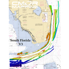
CMOR Mapping South Florida f/Simrad, Lowrance & Mercury

Shipping (3PM)
Within 30 days
CMOR Mapping South Florida f/Simrad, Lowrance & Mercury Product Description
South Florida for Simrad, Lowrance & Mercury
SEE IT. DIVE IT. FISH IT.
CMOR Mapping's game-changing, high-resolution bathymetric imagery for Simrad, Lowrance, B & G, and Raymarine chartplotters and Mercury VesselView displays brings the ocean floor into an entirely new level of focus for anglers and divers.
COMPLETE COVERAGE
CMOR Mapping data comes from methodical surveys of the entire bottom with high-resolution echosounders not point soundings and historical records.
UNPRECEDENTED DETAIL
With resolution as high as 1 meter meaning each pixel equals a square meter of bottom we show you every ledge, coral head, and sunken culvert in unprecedented detail.
SEAMLESS COMPATIBILITY
Just insert a CMOR Mapping card into your plotter and zoom in to see bathymetric imagery. Your vessel icon shows your exact location relative to bottom features.
The South Florida CMOR Card includes coverage of:
The South Florida CMOR Card Covers from Jensen Beach to Key West on the Atlantic Coast. New Deep Drop and Swordfish Grounds have been added from Stuart down through Miami. The Jensen Beach to North Mia coverage is over 500 square miles of Florida's most unique reef systems, artificial reefs and famous shipwrecks. The high-resolution coverage starts at Jensen Beach and continues all the way down to Golden Beach, located just north of Haulover Inlet. The depths covered on this card range from 1' at the shoreline to 120', which is past the 3rd reef line for the majority of the area. The areas colored in dark blue and purple extend to over 400' deep.
CMOR Mapping SOFL003R CMOR Card South Florida Navico
Model: SOFL003SThe South Florida v3 CMOR Card Covers from Jensen Beach through Key West on the Atlantic Coast and features private data collection from 2020.
This high resolution, 3D fishing map unlocks new grounds with a visual like never before — exclusively available on CMOR Mapping South Florida version 3.
Continuous nearshore expansion from Boynton Beach through North Miami, with depths ranging from 100ft to 400ft along the coastline.
Continuous nearshore expansion from Alligator Light through Ocean Reef, with depths ranging from 50ft to 250/300ft.
Strategic rescanning of objects subject to movement such as wrecks, as well as newly sunken objects and vessels.
Significant addition of nearshore and deep drop coverage throughout Key West, with continuing deep drop coverage through the upper keys.
The Jensen Beach to North Miami coverage features Florida's most unique reef systems, artificial reefs, and famous shipwrecks.
The depths covered on this card range from 1' at the shoreline to over 400', which is past the third reef line for the majority of the area.
The Miami-Biscayne features some of the most pristine diving and fishing areas in South Florida.
The depths covered on nearshore section range from 1' in Biscayne Bay to 500' due east of Government Cut.
Also included are the premier deep-dropping and daytime swordfishing grounds in South Florida. The depths range from 900' to 2,900'. Some of the largest swordfish in South Florida have been caught in this area. This is also a great area to target rosy snapper, queen snapper, snowy grouper, and many other deep-water bottom fish.
CMOR cards for Navico products are compatible with:
Lowrance
HDS Gen1 series
HDS Gen2 series (both keypad and touchscreen)
HDS Gen3 series
HDS Carbon
Elite HDI series
Elite CHIRP series
Elite Ti series
HOOK series
Simrad
NSS
NSS evo2
NSS evo3
NSE
NSO
NSO evo2
NSO evo3
GO XSE
GO XSR
Mercury VesselView
502
702
703
903
B&G
Zeus
Zeus Touch
Zeus2
Zeus3
Vulcan
Frequently Asked Questions (FAQ) About CMOR Mapping South Florida f/Simrad, Lowrance & Mercury
Who is the CMOR Mapping?Who is the CMOR Mapping?
Buy with the best price CMOR Mapping South Florida f/Simrad, Lowrance & Mercury for only $702 from NVN Marine! Same day shipping before 3pm.
CMOR Mapping South Florida f/Simrad, Lowrance & Mercury Technical Specifications
| Type: | |
|---|---|
| Vendor: |
CMOR Mapping |
| Weight: |
0.1 lb |
| Categories v2: |
Cartography | CMOR Mapping |
| Category v1: |
CARTOGRAPHY |
| UPC: |
850001904353 |
CMOR Mapping South Florida f/Simrad, Lowrance & Mercury User Reviews
CMOR Mapping South Florida f/Simrad, Lowrance & Mercury Shipping & Return
| Shipping Weight: |
0.1 lb |
|---|---|
| Box Sizes: |
1.00 (h) x 8.00 (w) x 5.00 (l) |
| Cubic Feet: |
40.0 |
| Returnable: |
Yes |
| USPS First Class: |
Yes |
For detailed shipping policy please check our Shipping Policy and you can find our Return and Refund Policy here.