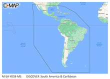
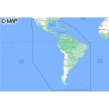
C-MAP M-SA-Y038-MS Discover South America & Caribbean
C-MAP M-SA-Y038-MS Discover South America & Caribbean Product Description
C-Map Max-N+ Charts on SD/Micro-SD Cards For use on B&G, Simrad, and Lowrance Chartplotters C-MAP MAX-N+ brings trusted C-MAP data and advanced charting features to users of compatible Lowrance, Simrad and B&G navigation systems. Whether you're an avid saltwater angler, sailing enthusiast or long-range cruiser, these powerful charts will enhance every moment you spend on the water. With huge coverage areas, up-to-date data and state-of-the-art features, no adventure is out of reach.
CMAP MSAY038MS Attributes
CMAP MSAY038MS Features & Benefits
- Accurate, up-to-date vector chart detail including Depth Areas and Contours, Spot Soundings, NavAids, Light Sectors, Wrecks/Obstructions, Small Craft Facilities and more
- Dynamic raster charts, for a "paper chart" look
- High resolution satellite imagery
- High resolution bathy fishing charts and data
- 3D view, custom shaded areas and aerial photos
- Tides and currents
- Features Harbor and approach details, Detailed port plans, Restrictions, prohibited areas and Spot sounding
- Depth contours, Inland rivers and lakes (where available)
- Submerged, wreck, pipelines, cables, and other obstructions
M-SA-Y038-MS DISCOVER™ South America and Caribbean
Whether cruising, fishing or sailing, C-MAP DISCOVER™ offers ultra-wide coverage and includes all of the core features you need to make the most of your time on the water. DISCOVER includes full-featured Vector Charts, with Custom Depth Shading, Tides & Currents and Easy Routing. It also includes the very best of C-MAP High Resolution Bathymetry, including integrated Genesis® data. Includes a full 12 months of online updates.
Full Featured Vector Charts
Provide boaters with the accurate, up-to-date vector chart detail including Depth Areas & Contours, Spot Soundings, NavAids, Light Sectors, Wrecks/Obstructions, and more.
Custom Depth Shading
Contours to display the highest level of information about underwater pinnacles, ledges and canyons that are magnets for offshore and coastal game fish.
High Resolution Bathymetry
High resolution detail of nearshore & offshore features such as pinnacles, canyons and ledges helping anglers find and target fish-rich waters.
Easy Routing
Automatically plots the shortest, safest route based on detailed chart data and vessel information. Takes two points and generates a suggested route.
Tides & Currents
Feature presents the time, water level and direction of tides with Tide Level graphs and indicates predicted current time, direction and strength. Flow graphs and coloured arrows.
Features:
- Ultra-Wide Coverage – the largest geographical coverage, without compromising on chart quality.
- Full Featured Vector Charts – making navigation easy by giving you accurate, up-to-date vector chart detail derive from official Hydrographic Office information.
- Custom Depth Shading – set a clear safety depth, maintain a paper-like view or create your own custom shading.
- High-Resolution Bathymetry – HRB layer helps you identify shallow areas, drop-offs, ledges, holes or humps. Now includes compiled and quality-controlled Genesis detail as part of singular HRB layer.
- Easy Routing – helps you automatically plot the shortest, safest route based on detailed chart data and your personalized vessel information.
- Tides & Currents – shows projections of water level and direction of tides to help plan your day out, cruising, angling or sailing.
- Detailed Marina Port Plans – docking in an unfamiliar port is no problem when you have precise layouts of thousands of marinas, including slip spaces, restricted areas and other valuable navigation information.
- Harbor & Approach Details – unprecedented level of detail. Approach any harbor and inlet with confidence. The perfect conclusion to a long voyage, sailing adventure or an exciting day of fishing.
- Online Updates – keep your chart up to date, with 12 months’ free online updates.
M-SA-Y038-MS DISCOVERâ„¢ South America and the Caribbean Whether cruising, fishing or sailing, C-MAP DISCOVERâ„¢ has an ultra-wide coverage and includes all the core functions you need to make the most of your...
Frequently Asked Questions (FAQ) About C-MAP M-SA-Y038-MS Discover South America & Caribbean
Who is the C-MAP?How to describe C-MAP M-SA-Y038-MS Discover South America & Caribbean?
Who is the C-MAP?
How to describe C-MAP M-SA-Y038-MS Discover South America & Caribbean?
Buy with the best price C-MAP M-SA-Y038-MS Discover South America & Caribbean for only $129 from NVN Marine! Same day shipping before 3pm.
C-MAP M-SA-Y038-MS Discover South America & Caribbean Technical Specifications
| Type: | |
|---|---|
| Vendor: |
C-MAP |
| Weight: |
0.1 lb |
| User Guide: |
C-MAP M-SA-Y038-MS Discover South America & Caribbean User Reviews
C-MAP M-SA-Y038-MS Discover South America & Caribbean Shipping & Return
| Shipping Weight: |
0.1 lb |
|---|---|
| Box Sizes: |
1.00 (h) x 5.00 (w) x 6.00 (l) |
| Cubic Feet: |
30.0 |
| Returnable: |
Yes |
For detailed shipping policy please check our Shipping Policy and you can find our Return and Refund Policy here.


