
CMOR Mapping Florida Middle Grounds Version 3 f/Raymarine

Shipping (3PM)
Within 30 days
CMOR Mapping Florida Middle Grounds Version 3 f/Raymarine Product Description
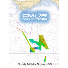
Florida Middle Grounds Version 3 for Raymarine
SEE IT. DIVE IT. FISH IT.
CMOR Mapping's game-changing, high-resolution bathymetric imagery for Simrad, Lowrance, B & G, and Raymarine chartplotters and Mercury VesselView displays brings the ocean floor into an entirely new level of focus for anglers and divers.
COMPLETE COVERAGE
CMOR Mapping data comes from methodical surveys of the entire bottom with high-resolution echosounders not point soundings and historical records.
UNPRECEDENTED DETAIL
With resolution as high as 1 meter meaning each pixel equals a square meter of bottom we show you every ledge, coral head, and sunken culvert in unprecedented detail.
SEAMLESS COMPATIBILITY
Just insert a CMOR Mapping card into your plotter and zoom in to see bathymetric imagery. Your vessel icon shows your exact location relative to bottom features.
The Florida Middle Grounds CMOR Card includes coverage of three separate sections:
- The Middle Grounds section covers 656 square miles, with depths ranging from 75' to 225'.
- The Steam Boat Lumps section covers 150 square miles with depths ranging from 220' to 500'.
- The Elbow section covers 40 square miles with depths ranging from 144' to 215'.
The northern end of this extensive reef system lies approximately 65 nm south of Apalachicola, while its southeastern end lies about 70 nm west-northwest of Tampa.
Although the Middle Grounds is among the best fishing and diving areas in the Gulf of Mexico, it's still critical to know where you're going once you invest the time and fuel to make the trip.
CMOR Mapping bathymetry arms you with more and better data than anybody else on the water.
NOAA Chart 11006 is included in the background.
All CMOR Cards come on Micro SD cards with a standard SD adapter included.
CMOR CARDS ARE COMPATIBLE WITH THE FOLLOWING DEVICES:
Raymarine
CMOR cards are compatible with all units capable of running the Lighthouse II and Lighthouse 3 interfaces. In order to support CMOR Mapping, units must have at least v17 software installed. Units include:
- Axiom Series
- Axiom Pro
- Hydbrid Touch
- aSeries
- cSeries
- eSeries
- eS Series
- gS Series
- Dragonfly Series
Frequently Asked Questions (FAQ) About CMOR Mapping Florida Middle Grounds Version 3 f/Raymarine
Who is the CMOR Mapping?Who is the CMOR Mapping?
Buy with the best price CMOR Mapping Florida Middle Grounds Version 3 f/Raymarine for only $702 from NVN Marine! Same day shipping before 3pm.
CMOR Mapping Florida Middle Grounds Version 3 f/Raymarine Technical Specifications
| Type: | |
|---|---|
| Vendor: |
CMOR Mapping |
| Categories v2: |
Cartography | CMOR Mapping |
| Category v1: |
CARTOGRAPHY |
| User Guide: |
CMOR Mapping Florida Middle Grounds Version 3 f/Raymarine User Reviews
CMOR Mapping Florida Middle Grounds Version 3 f/Raymarine Shipping & Return
For detailed shipping policy please check our Shipping Policy and you can find our Return and Refund Policy here.