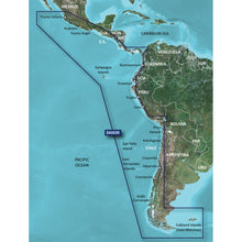
Garmin BlueChart® g3 HD - HXSA002R - South America West Coast - microSD™/SD™
- "Our Advanced Chart Offering."
- "Detailed charts help the mariner guide their boat in and out of port with confidence."
- "Depth Range Shading."
- "Displays high-resolution Depth Range Shading for up to 10 depth ranges so you can view your designated target depth."
- "Detailed Contours."
Garmin BlueChart® g3 HD - HXSA002R - South America West Coast - microSD™/SD™ Product Description
Explore the Vast West Coast of South America with Precision Mapping
Imagine navigating the rugged shores from Acapulco's bustling marinas down to the windswept tip of Tierra del Fuego, or threading through the Panama Canal's locks with confidence. This chart package delivers intricate details for those epic coastal voyages, including the Galapagos Islands' volcanic bays, Lake Titicaca's high-altitude waters, and the remote Falkland Islands. Mariners tackling long-haul passages or island-hopping adventures find unmatched reliability here, blending official hydrographic data with enhanced Garmin insights for safer, smoother journeys.
Whether you're a seasoned cruiser eyeing Panama's east coast or a fishing enthusiast targeting rich grounds off San Felix Island, these charts illuminate every twist—from narrow canals to expansive harbors like Puerto Deseado.
Standout Features That Elevate Your On-Water Experience
- Integrated High-Definition Data: Seamlessly combines Garmin's proprietary layers with detailed Navionics content, offering spot soundings, tides, currents, and navigational aids that feel alive on your display.
- Smart Auto Guidance: Input your boat's draft and clearance needs, and it plots an intelligent path around obstacles, perfect for dodging shallows near the San Fernandez Islands or maneuvering marinas.
- Multi-Range Depth Shading: Customize up to 10 shading levels to spotlight your ideal fishing or anchoring depths, making split-second decisions intuitive even in choppy conditions.
- Ultra-Fine Contours: 1-foot intervals reveal subtle bottom structures, turning swamps, inland waterways, and port approaches into navigable playgrounds for anglers and explorers alike.
- Shallow Water Highlighting: Set your own threshold to visually flag hazards, a game-changer for low-tide runs along Central America's coastlines.
Why Boaters Rely on These Charts for South American Adventures
In regions like this, where weather shifts fast and charts can mean the difference between a triumphant crossing and a grounded hull, precision matters. Fishermen chasing billfish near the Galapagos appreciate the hyper-detailed bathymetry for spotting drop-offs. Yacht owners transiting the Panama Canal praise the current predictions and lock approaches. Even inland explorers on Lake Titicaca benefit from contour accuracy in reed-choked shallows.
Upgrade your chartplotter's view to reveal harbor plans with quay layouts, beacon positions, and restricted zones—details that foster trust during night watches or unfamiliar anchorages. It's not just mapping; it's your virtual first mate for the Americas' wilder waters.
Pro Tips for Seamless Integration and Use
Slide the microSD or SD card into your compatible chartplotter, and watch the region come alive—no complex setup required. Layer on satellite imagery for daytime overviews, then switch to high-contrast night modes for those starry Falklands arrivals. For best results, calibrate your transducer with the depth shading to sync live sonar with charted contours, amplifying fish-finding prowess.
Regular updates keep tides and notices current, ensuring your passages stay ahead of changes. Pair with a Garmin handheld for backup during shore excursions, blending marine and land navigation effortlessly.
Frequently Asked Questions
What areas does this chart cover along South America's west coast?
It spans from Acapulco, Mexico, southward to Tierra del Fuego, then up to Puerto Deseado, Argentina. Key inclusions are Panama's east coast and Canal, Galapagos Islands, Lake Titicaca, Falklands, and islands like San Felix and San Fernandez.
How does Auto Guidance help with navigation here?
It computes routes based on your vessel's depth and overhead limits, suggesting safe paths through tricky spots like canal systems or reef-fringed islands, saving time and reducing stress.
Can I use the depth shading for fishing?
Absolutely—select up to 10 ranges to highlight prime depths, paired with 1-foot contours for pinpointing structures where game fish congregate along these coasts.
Is this compatible with my Garmin chartplotter?
Yes, it's designed for Garmin chartplotters that support BlueChart g3 HD, loading directly via microSD or SD card for instant access.
What makes the shallow water shading useful?
You define the depth threshold, shading risks visually—ideal for exploring uncharted bays or running aground-prone beaches common in this region.
Does it include tides and currents?
Yes, detailed tidal and current info supports planning for Panama Canal transits or anchoring in tidal Falkland harbors.
Experience unparalleled coverage and brilliant detail when you're on the water with charts that feature integrated Navionics ® data, Auto Guidance technology and more.
Garmin 010C106320 Attributes
- Compatibility: Compatible With Chart Plotters
- Chart Coverage: HXSA002R South America And West Coast
- Storage: On SD/ Micro-SD Card
Garmin 010C106320 Features & Benefits
- Provides Exceptional Coverage, Clarity And Detail With Coastal Charts That Feature Integrated Garmin And Navionics ® Data
- Auto Guidance Technology Calculates A Route Using Your Desired Depth And Overhead Clearance And Provides A Suggested Path To Follow
- Provides Depth Range Shading For Up To 10 Depth Ranges, Enabling You To View Your Target Depth At A Glance
- Up To 1 Foot Contours Provide A More Accurate Depiction Of The Bottom Structure For Improved Fishing Charts And Navigation In Swamps, Canals And Marinas
- To Aid In Navigation, Shallow Water Shading Allows Map Shading At A User-Defined Depth To Give A Clear Picture Of Shallow Waters
- Limited One Year Consumer Warranty
Garmin 010C106320 Warranties
BlueChart® g3 HD - HXSA002R - South America West Coast - microSD
™/SD™
Coverage of the west coast of Central and South America from Acalpulco, Mexico to Tierra del Fuego and then north to Puerto Deseado, Argentina. Coverage also includes the east coast of Panama; the Panama Canal; the Galapagos Islands; Lake Titicaca; the Falkland Islands (Islas Malvinas); San Felix Island and the San Fernandez Islands including Selkirk.
Our Advanced Chart Offering
- Derived from official charts and private sources to provide navigational aids, spot soundings, depth contours, tides and currents, and detailed harbors and marinas
- Depth Range Shading for up to 10 depth ranges enables you to view your target depth at a glance
- Up to 1-foot contours provide a more accurate depiction of the bottom structure for improved fishing charts and navigation in swamps, canals and marinas
- Shallow Water Shading feature allows for depth shading at a user-defined level to aid in navigation
Advanced Chart Detail
Detailed charts help the mariner guide their boat in and out of port with confidence.
Depth Range Shading
Displays high-resolution Depth Range Shading for up to 10 depth ranges so you can view your designated target depth.
Detailed Contours
BlueChart g3 HD features 1-foot contours that provide a more accurate depiction of bottom structure for improved fishing charts and enhanced detail in swamps, canals and port plans.
This product may not be returned to the original point of purchase. Please contact the manufacturer directly with any issues or concerns."Advanced Chart Detail Depth Range Shading Detailed Contours BlueChart g2 HD features 1-foot contours that provide a more accurate depiction of bottom structure for improved fishing charts and enhanced detail in swamps, canals and port plans."
Frequently Asked Questions (FAQ) About Garmin BlueChart® g3 HD - HXSA002R - South America West Coast - microSD™/SD™
Who is the Garmin?How to describe Garmin BlueChart® g3 HD - HXSA002R - South America West Coast - microSD™/SD™?
What is the type of the product?
What is the cartography of product?
What is the compatibility of this product?
What is the connection interface of product?
What is the card type of this product?
Who is the Garmin?
How to describe Garmin BlueChart® g3 HD - HXSA002R - South America West Coast - microSD™/SD™?
What is the type of the product?
- Precision and Accuracy: View the exact position of your vessel, detailed coastal features, anchorages, obstructions, waterways, tidal stations, currents, and depth contours so you will always know precisely where you are and where you want to go.
- Fishing Features: Local fishing charts give even first-time visitors a local’s advantage.
- Safety in Visibility: This card includes local depth contours so you can feel confident navigating over any marine landscape.
What is the cartography of product?
What is the compatibility of this product?
What is the connection interface of product?
What is the card type of this product?
Save $27 when you buy the Garmin BlueChart® g3 HD - HXSA002R - South America West Coast - microSD™/SD™ for only $122 from NVN Marine! Same day shipping before 3pm.
Garmin BlueChart® g3 HD - HXSA002R - South America West Coast - microSD™/SD™ Technical Specifications
| Type: | |
|---|---|
| Vendor: |
Garmin |
| Weight: |
0.1 lb |
| Product Manual: |
Garmin BlueChart® g3 HD - HXSA002R - South America West Coast - microSD™/SD™ User Reviews
Garmin BlueChart® g3 HD - HXSA002R - South America West Coast - microSD™/SD™ Shipping & Return
| Shipping Weight: |
0.1 lb |
|---|---|
| Box Sizes: |
0.00 (h) x 5.00 (w) x 5.00 (l) |
| Cubic Feet: |
0.0 |
| USPS First Class: |
Yes |
| P65: |
Yes |
For detailed shipping policy please check our Shipping Policy and you can find our Return and Refund Policy here.


