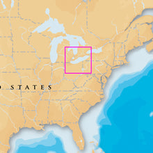
Navionics Platinum+ - Lake Erie & Saint Clair - microSD™/SD™
It will be shipped by UPS Ground.
Navionics Platinum+ - Lake Erie & Saint Clair - microSD™/SD™ Product Description
Navionics Platinum+ ™ charts include all the content of Navionics (R)+ cartography, with integrated offshore and inland mapping, 42,000+ lakes and additional viewing options for relief shading, satellite imagery with SonarChart shading overlay, 3D perspective view, aerial photos and more.
Navionics 010C137040 Attributes
- Compatibility: Chart Plotters
- Chart Coverage: US East
- Storage: On SD/ Micro-SD Card
Navionics 010C137040 Features & Benefits
- Nautical Chart: Comprehensive Charts Are Derived From Multiple Official, Government And Private Sources, Displayed In A Familiar Look And Feel
- Community Edits: Get Useful Local Knowledge From Edits Made By Users Of The Navionics Boating App On Your Compatible Smart Device
- Dock-To-Dock Route Guidance: Start Your Trip With A Suggested Path
- SonarChart Live Mapping Feature:
- Watch New HD Depth Maps Develop In Real Time As Your Boat Moves Through The Water
- 3D View: Adjust The Perspective Of Your Chart View To Highlight Key Features And Enhance Awareness
- Aerial Photos: Get A Better Sense Of Your Surroundings
- Limited Supplier Warranty
Platinum+ - Lake Erie & Saint Clair - microSD™/SD™
- Marine charts
- One foot contours inshore and nearshore
- 3’ and 6’ contours offshore beyond 90’
- Daily updates and advanced features for one year
Head out with confidence! All the same marine content and advanced features found in Navionics+ are augmented with 3D View, satellite overlay and panoramic photos to provide the ultimate situational awareness. Designed with the most demanding boaters and serious anglers in mind, these additional viewing options can be used on a growing number of GPS plotters. Quickly target the best spots and catch more fish! Daily updates and advanced features are included for one year. Simply plug your card into your PC/Mac and register online at navionics.com. USB reader provided.
- Preloaded with Nautical Chart and SonarChart™; Community edits are downloadable.
- Enjoy advanced features: SonarChart™ Live, Advanced Map Options and Plotter Sync.
- Enhance SonarChart™ with sonar logs you collect .
- Included tides & currents, safety depth contours, navaids, coastal points of interest, and port services information.
Go out with confidence! All the same ocean and lake content and advanced features found in Navionics+ are enhanced with 3D views, satellite overlays and panoramic photos to...
Frequently Asked Questions (FAQ) About Navionics Platinum+ - Lake Erie & Saint Clair - microSD™/SD™
Who is the Navionics?How to describe Navionics Platinum+ - Lake Erie & Saint Clair - microSD™/SD™?
What is the type of the product?
What is the cartography of product?
What is the compatibility of this product?
What is the connection interface of product?
What is the card format of this product?
What is the card type of this product?
Who is the Navionics?
How to describe Navionics Platinum+ - Lake Erie & Saint Clair - microSD™/SD™?
What is the type of the product?
What is the cartography of product?
What is the compatibility of this product?
What is the connection interface of product?
What is the card format of this product?
What is the card type of this product?
Save $48 when you buy the Navionics Platinum+ - Lake Erie & Saint Clair - microSD™/SD™ for only $201 from NVN Marine! Same day shipping before 3pm.
Navionics Platinum+ - Lake Erie & Saint Clair - microSD™/SD™ Videos
Navionics Platinum+ - Lake Erie & Saint Clair - microSD™/SD™ Technical Specifications
| Type: | |
|---|---|
| Vendor: |
Navionics |
| Weight: |
0.3 lb |
| Card Format: |
MicroSD/SD |
| User Guide: | |
| Product Brochure: |
Navionics Platinum+ - Lake Erie & Saint Clair - microSD™/SD™ User Reviews
Navionics Platinum+ - Lake Erie & Saint Clair - microSD™/SD™ Shipping & Return
| Shipping Weight: |
0.3 lb |
|---|---|
| Box Sizes: |
1.00 (h) x 4.00 (w) x 6.00 (l) |
| Cubic Feet: |
24.0 |
| USPS First Class: |
Yes |
For detailed shipping policy please check our Shipping Policy and you can find our Return and Refund Policy here.


