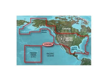
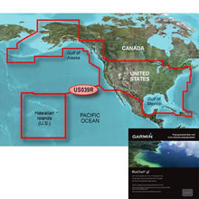
Garmin BlueChart® g3 HD - HXUS604x - US All & Canadian West - microSD™/SD™ Product Description
Explore Every Corner of North American Waters with Precision Mapping
Whether you're plotting a course along the rugged Pacific Northwest, chasing trophy fish in the Great Lakes, or navigating the intricate channels of the Florida Keys, this chart pack unlocks detailed hydrographic data for safe and confident voyages. Covering the full expanse of U.S. coastlines from the Atlantic to the Pacific, plus key Canadian regions, inland waterways, and island chains, it equips your chartplotter with the clarity needed for everything from weekend cruises to extended offshore adventures.
Imagine threading through the Inside Passage off Vancouver Island or anchoring in the Bahamas without second-guessing your position—these charts make it possible by blending high-resolution bathymetry with intuitive navigation aids.
Comprehensive Regional Coverage Tailored for Adventurers
-
U.S. East Coast: From Key West up to the Canadian border, capturing every inlet, harbor, and coastal feature.
-
U.S. West Coast: Puget Sound to the Mexican border, ideal for coastal hopping and Pacific exploration.
-
Alaska and Hawaii: Remote archipelagos and Aleutian Islands for those seeking untouched waters.
-
Gulf Coast: U.S. and Mexican sides to the Yucatan, perfect for Gulf Stream runs.
-
Great Lakes and Inland Rivers: Complete coverage including Lake of the Woods, St. Lawrence Seaway, and major rivers for freshwater navigation.
-
Canada Highlights: Nova Scotia, New Brunswick, Prince Edward Island, Anticosti Island.
-
Caribbean Extensions: Bahamas, Turks and Caicos, Cozumel, Cuba, Hispaniola, Puerto Rico, U.S. Virgin Islands, and Channel Islands.
This vast footprint means one card handles transcontinental trips, reducing the hassle of swapping maps mid-journey.
Standout Features That Elevate Your On-Water Experience
Auto Guidance: Your Virtual First Mate
Enter your boat's draft and bridge clearances, and watch as the system plots an optimized route overlaid directly on your chart. It's a game-changer for unfamiliar bays or crowded marinas, saving time and reducing stress. Boaters report shaving hours off approach times to tricky anchorages like those in the San Juan Islands.
Depth Range and Shallow Water Shading: Spot Hazards Instantly
Customize up to 10 depth bands to highlight your safe operating range, with shallow areas shaded for quick visual alerts. Pair this with user-defined shallow shading to ghost out sandbars or shoals—essential for low-tide runs in the Chesapeake or skinny water fishing in the Everglades.
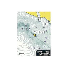
1-Foot Contours: Pinpoint Bottom Structure
Finer than standard charts, these contours reveal drop-offs, humps, and ledges with pinpoint accuracy. Anglers use them to target structure in reservoirs, while cruisers appreciate the detail in narrow canals and swampy routes.
NOAA Raster Cartography: Familiar Paper-Chart Feel
Downloadable through the ActiveCaptain app, this layers traditional NOAA views with lat/long labels over digital charts. It's like having a stack of paper charts in your plotter, bridging old-school reliability with modern tech for confident positioning in surveyed zones.
Powered by fused Garmin and Navionics data, these elements deliver sharper visuals and more reliable intel than standalone charts, trusted by commercial operators and recreational skippers alike.
Pro Tips for Getting the Most from Your Charts
Slip the microSD/SD card into your compatible Garmin chartplotter for instant access—no internet required offshore. Update via ActiveCaptain for the latest surveys, and overlay with sonar data for real-time bottom tracking. For fishing, zoom into 1-foot contours during dawn patrols; for cruising, rely on Auto Guidance to dodge no-go zones. Always cross-reference with local knowledge and current conditions for safest passage.
| Feature |
Benefit |
| Integrated Garmin/Navionics Data |
Superior detail and coverage |
| Auto Guidance |
Custom route planning |
| Depth Range Shading (10 levels) |
Target depth visualization |
| 1' Contours |
Precise bathymetry |
| Shallow Water Shading |
Hazard avoidance |
| NOAA Raster (App Download) |
Paper-chart overlay |
Frequently Asked Questions
What areas does this chart cover?
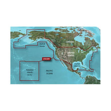
It spans U.S. East and West Coasts, Gulf of Mexico, Alaska, Hawaii, major inland rivers, Great Lakes, and select Canadian coastal regions including Vancouver Island and the St. Lawrence Seaway, plus Caribbean islands like the Bahamas and Puerto Rico.
How does Auto Guidance work?
You input your vessel's depth requirements and overhead clearances, and it generates a suggested path overlaid on the chart, ideal for planning routes in complex areas.
Is NOAA raster cartography included?
Yes, it's available as a free download via the ActiveCaptain app, providing paper-like NOAA views with labeled points of interest.
What's the benefit of 1-foot contours?
They offer hyper-detailed bottom profiles, helping anglers locate fish-holding structure and navigators avoid subtle hazards in shallow or confined waters.
Can I customize depth shading?
Absolutely—set up to 10 depth ranges and shallow water thresholds to match your boat and conditions for at-a-glance safety.
What devices is this compatible with?
It's designed for Garmin chartplotters that support BlueChart g3 cards, loading seamlessly via microSD or SD slot.
Does it update automatically?
Use the ActiveCaptain app to download the latest chart updates and enhancements wirelessly when connected.
Experience unparalleled coverage and brilliant detail when you're on the water with charts that feature integrated Navionics ® data, Auto Guidance technology and more.
Garmin 0C101820PB Attributes
-
Compatibility: Compatible With Chart Plotters
-
Chart Coverage: HXUS604X All US And Canada West Coast
-
Storage: On SD/ Micro-SD Card
Garmin 0C101820PB Features & Benefits
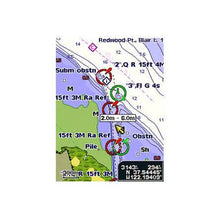
- Provides Exceptional Coverage, Clarity And Detail With Coastal Charts That Feature Integrated Garmin And Navionics ® Data
- Auto Guidance Technology Calculates A Route Using Your Desired Depth And Overhead Clearance And Provides A Suggested Path To Follow
- Provides Depth Range Shading For Up To 10 Depth Ranges, Enabling You To View Your Target Depth At A Glance
- Up To 1 Foot Contours Provide A More Accurate Depiction Of The Bottom Structure For Improved Fishing Charts And Navigation In Swamps, Canals And Marinas
- To Aid In Navigation, Shallow Water Shading Allows Map Shading At A User-Defined Depth To Give A Clear Picture Of Shallow Waters
- NOAA Raster Cartography Is Provided As A Free Downloadable Feature Via The ActiveCaptain ® App
- NOAA Raster Cartography Gives Your Chartplotter Paper Chart like Views Of NOAA-Surveyed Areas In Which Points Of Interest Are Labeled With Corresponding Longitude And Latitude Information
- Limited One Year Consumer Warranty
Garmin 0C101820PB Warranties
BlueChart® g3 HD - HXUS604x - US All & Canadian West - microSD™/SD™
Coverage
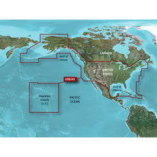
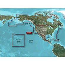
Provides detailed coastal coverage of the U.S., including the East Coast from Key West, FL, to the Canadian border, and the West Coast from Puget Sound to the Mexican border; Alaska; Hawaii and major inland rivers; the U.S. Gulf Coast to the Mexican border and the Mexican Gulf Coast to the Yucatan. Canadian coverage includes the entire St. Lawrence Seaway, Nova Scotia and New Brunswick. The Great Lakes are covered in their entirety as are the Lake of the Woods. Coverage includes Prince Edward Island, Anticosti Island, Vancouver Island, including the Inside and Outside Passages, the Aleutian and Channel Islands, the Bahamas, the Turks and Caicos Islands, Cozumel, Cuba, Hispaniola, Puerto Rico and the U.S. Virgin Islands.
Unparalleled Coastal Chart Coverage
- Provides industry-leading coverage, clarity and detail with updated coastal charts that feature integrated Garmin and Navionics® data
- Auto Guidance¹ technology calculates a route using your desired depth and overhead clearance and provides a suggested path to follow
- Includes Depth Range Shading for up to 10 depth ranges, enabling you to view your target depth at a glance
- Up to 1’ contours provide a more accurate depiction of the bottom structure for improved fishing charts and navigation in swamps, canals and marinas
- NOAA raster cartography² is available as a free downloadable feature via the ActiveCaptain® app
BlueChart g3 coastal charts provide industry-leading coverage, clarity and detail with integrated Garmin and Navionics data. Also included is Auto Guidance¹ technology, which uses your desired depth and overhead clearance to calculate routes and provide a suggested path to follow — overlaid onto your chart. NOAA raster cartography is also available as a free downloadable feature via the ActiveCaptain app. It gives your chartplotter paper chartlike views of NOAA-surveyed areas in which individual points of interest are labeled with corresponding longitude and latitude information. Worldwide coverage is available by regions as accessory cards or via download; each region is sold separately.
Auto Guidance Technology
The Auto Guidance feature¹ calculates a suggested route using your desired depth and overhead clearance.
Depth Range Shading
This feature displays high-resolution Depth Range Shading for up to 10 depth ranges so you can view your designated target depth.
Detailed Contours
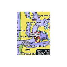
BlueChart g3 features up to 1’ contours, which provide a more accurate depiction of the bottom structure for improved fishing charts and navigation in swamps, canals and marinas.
Shallow Water Shading
To aid in navigation, Shallow Water Shading allows map shading at a user-defined depth to give a clear picture of shallow waters to avoid.
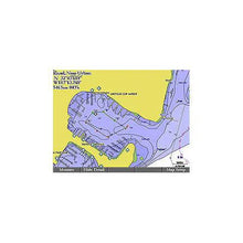
NOAA Raster Cartography
This feature gives your chartplotter paper chartlike views of NOAA-surveyed areas in which points of interest are labeled with corresponding longitude and latitude information.
¹Auto Guidance is for planning purposes only and does not replace safe navigation operations
²Raster cartography cannot be viewed on echoMAP CHIRP and ECHOMAP Plus combos but can be viewed on mobile devices via the ActiveCaptain mobile app .
This product may not be returned to the original point of purchase. Please contact the manufacturer directly with any issues or concerns. ". . Standard 2-D direct overhead or 3-D \u201cover the bow\u201d map perspective for easy chart reading and orientation. . . Plan and organize routes from your computer with HomePort (sold separately)."
Frequently Asked Questions (FAQ) About Garmin BlueChart® g3 HD - HXUS604x - US All & Canadian West - microSD™/SD™
Who is the Garmin?
How to describe Garmin BlueChart® g3 HD - HXUS604x - US All & Canadian West - microSD™/SD™?
What is the compatibility of this product?
Who is the Garmin?
Garmin is a leader in Global Positioning System (GPS) technology and an innovator in consumer electronics. Garmin serves both the aviation and consumer markets. Garmin's products are used in flying, boating, driving, hiking, and many other activities. Specifically, Garmin aims to enrich the lives of customers, suppliers, distributors, and employees by providing the very best products that offer superior quality, safety, and operational features at affordable prices.
How to describe Garmin BlueChart® g3 HD - HXUS604x - US All & Canadian West - microSD™/SD™?
. . Standard 2-D direct overhead or 3-D "bow" map perspective, easy to read and orient the chart. . . Use HomePort (sold separately) to plan and organize routing from your computer.
What is the compatibility of this product?
Compatible With Chart Plotters
Save
$40 when you buy the
Garmin BlueChart® g3 HD - HXUS604x - US All & Canadian West - microSD™/SD™ for only
$179 from NVN Marine! Same day shipping before 3pm.


