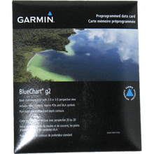
Garmin 101133301 Marine Cartography
Garmin 101133301 Marine Cartography Product Description
Discover Seamless Navigation with Garmin BlueChart g2 Pacific Coverage
Enhance your on-water adventures across the vast Pacific regions with Garmin's BlueChart g2 marine cartography. Designed for precision and clarity, this charting solution transforms your Garmin chartplotter into a reliable companion for coastal cruising, offshore fishing, and exploratory sailing. Unlike basic maps, it delivers layered, high-resolution graphics that blend effortlessly, allowing smooth transitions as you pan, zoom, and scroll through intricate waterways. The vibrant shading and intuitive symbology mirror traditional paper charts, ensuring quick orientation even in challenging conditions.
Whether you're plotting a course through busy harbors or hunting prime fishing spots in remote atolls, these charts provide the depth of detail serious mariners demand. Experience the freedom of choosing between an immersive 3D perspective for better depth perception or the classic 2D overhead view for straightforward plotting—all styled to feel familiar and trustworthy on your display.
Key Features That Set It Apart
- Shaded Depth Contours and Spot Soundings: Visualize underwater terrain with precision, highlighting inter-tidal zones to avoid shallows and identify anchorages confidently.
- Full Bathymetric Fishing Charts: Detailed contours reveal drop-offs, humps, and ledges where fish congregate, giving anglers a competitive edge in Pacific waters.
- Tidal Current Overlays: Real-time flow predictions help optimize drift fishing, sail timing, and safe passage through tidal straits.
- Comprehensive Aids to Navigation: IALA-standard buoys, beacons, and lights include sector visibility ranges for safer nighttime or foggy approaches.
- Marina and Slipway Points of Interest: Locate fuel docks, repairs, and berths with ease, complete with contact details for hassle-free planning.
- Vector-Based Data: Object-oriented design ensures scalability without losing detail, supporting seamless integration across compatible Garmin systems.
- Dual-View Mapping: Switch effortlessly between 2D for precise bearings and 3D for spatial awareness, enhancing situational awareness.
Why Pacific Mariners Choose BlueChart g2
For boaters navigating the diverse Pacific— from Hawaii's volcanic coasts to Australia's Great Barrier Reef approaches—these charts stand out with region-specific accuracy. Fishermen appreciate the bathymetric layers that uncover hidden structures, while cruisers value the marina directories and tidal data for stress-free voyages. Sailors benefit from shaded contours that reveal safe passages amid coral heads and reefs.
Integration is effortless with Garmin GPS navigation systems, updating your plotter's view in real-time as you move. The result? Fewer surprises, more confidence, and extended time enjoying the water rather than troubleshooting navigation.
Practical Tips for Maximum Value
- Pair with sonar transducers for live contour overlays during fishing runs.
- Use 3D mode in unfamiliar anchorages to gauge swing room and depths.
- Leverage tidal overlays for planning transits through narrow channels like those in Fiji or Vanuatu.
- Customize shading preferences to match lighting conditions for optimal visibility at dawn or dusk.
Reliable Coverage Tailored for the Pacific
This cartography spans key Pacific regular areas, delivering high-detail coverage of coastlines, ports, and offshore zones. From detailed harbor plans in New Zealand to open-water contours toward Polynesia, it's built for the unique challenges of island-hopping and long-range cruising in this expansive ocean.
Frequently Asked Questions
What regions does Garmin BlueChart g2 Pacific coverage include?
It provides detailed marine charts for Pacific regular areas, covering coastlines, harbors, and offshore waters ideal for cruising, fishing, and sailing in regions like Hawaii, New Zealand, and surrounding islands.
Is this compatible with all Garmin chartplotters?
Yes, it's designed for compatibility with Garmin GPS navigation systems and chartplotters that support BlueChart g2 maps, ensuring smooth integration.
What is the difference between 2D and 3D map views?
2D offers a direct overhead perspective like paper charts for precise measurements, while 3D provides a tilted, immersive view to better understand terrain, depths, and obstacles.
How do the bathymetric fishing charts help anglers?
These charts show detailed underwater contours, spot soundings, and structures like reefs and drop-offs, helping locate fish-holding areas in Pacific waters.
Does it include tidal and current information?
Yes, tidal current flow overlays provide directional and speed data, essential for timing passages and drift fishing.
What navigation aids are featured?
Comprehensive IALA navaid symbology with light sectors, ranges, buoys, and beacons for safe navigation day or night.
Are marina details included?
Yes, points of interest cover marinas, slipways, fuel, and services with practical location data.
Peace of Mind with Garmin Support
Backed by a limited one-year consumer warranty, this cartography reflects Garmin's commitment to quality marine electronics, ensuring reliability on every outing.
BlueChart ® G2 mapping features smooth layering and seamless integration of map graphics for easy panning, scrolling and zooming. With rich colors and shading for easy interpretation and clear visibility, this marine charting offers comprehensive IALA navaid symbology and marine services. And, best of all, it features a choice of 3-D map perspective, or the familiar 2D direct-overhead view - to make chart reading and orientation easier. BlueChart is styled to match the appearance of paper charts when displayed on your Garmin chartplotter.
Garmin 101133301 Attributes
- Compatibility: Compatible With GPS Navigation System
- Chart Coverage: Pacific Regular
Garmin 101133301 Features & Benefits
- Seamless Chart Presentation
- Aids To Navigation With View Range And Coverage Along Light Sectors Information
- Marina Points Of Interest And Slipways
- Full Bathymetric Fishing Charts Providing Detailed Contours
- Tidal Current Flow Overlay
- Vector Object Orientated Data
- Shaded Depth Contours And Inter-Tidal Zones With Spot Soundings
- 2D Or 3D Map Perspective View
- Limited One Year Consumer Warranty
Garmin 101133301 Warranties
Frequently Asked Questions (FAQ) About Garmin 101133301 Marine Cartography
Who is the Garmin?What is the compatibility of this product?
Who is the Garmin?
What is the compatibility of this product?
Save $1 when you buy the Garmin 101133301 Marine Cartography for only $158 from NVN Marine! Same day shipping before 3pm.
Garmin 101133301 Marine Cartography Technical Specifications
| Type: | |
|---|---|
| Vendor: |
Garmin |
| Weight: |
1.0 lb |
Garmin 101133301 Marine Cartography User Reviews
Garmin 101133301 Marine Cartography Shipping & Return
| Shipping Weight: |
1.0 lb |
|---|---|
| Box Sizes: |
1.00 (h) x 2.00 (w) x 2.00 (l) |
| Cubic Feet: |
4.0 |
| Returnable: |
Yes |
For detailed shipping policy please check our Shipping Policy and you can find our Return and Refund Policy here.


